Garniai hillfort
Garniai hillforts are in the territory of Utena district municipality, south-east of Daugailiai, near Garniai village.
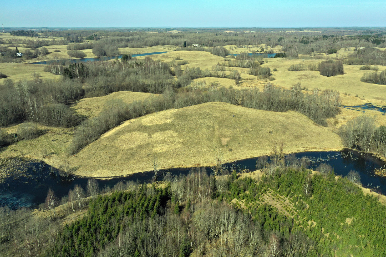
The first hillfort is situated east of Garniai village, 0.5km south-west of the lake Pelakis, on the left bank of the Kriauklė. The hill with steep slopes, up to 17m, is surrounded by ravines. The upper part of the slopes was artificially leveled off. The site 45m long, and 15–20m wide. On its ends there used to be ramparts, damaged by ploughing, but remained in the north-eastern part of the site of about l.5m in height. On the north-eastern slope, 7m below the site, there is a 26m wide terrace. On the southern slope and foot of the hillfort there are remains of an ancient settlement, where fragments of molded rough pottery were found.
The second hillfort is about 1km south-west of Garniai village, about 2km south-west of the first Garniai hillfort, between swampy ravines, north-east of Bernotiškiai village, on the edge of Bernotiškiai forest. The southern and northern slopes of the hillfort are steep, up to 17m high, the rest of the slopes are incline, 3–4m high. The site 35 x 19m; at its ends there were small ramparts (damaged by ploughing). On the western slope of the hill, 3m below the site, there is a 2m wide terrace. At the southern, eastern and northern foothills of the hillfort there are remains of an ancient settlement where molded smooth pottery was found. The hillforts date back to the I millennium. Exploratory archaeological research was carried out; the findings are kept in the Lithuanian National Museum. The hillforts have not been explored more thoroughly.